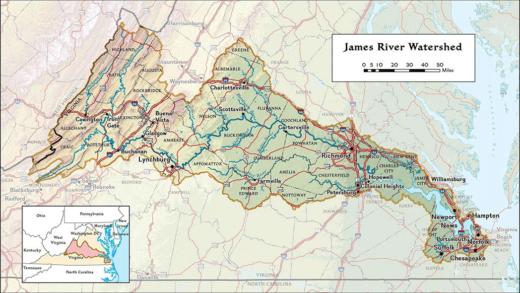
The James River Watershed
|
The James River is Virginia’s largest river, flowing across the entire state. It begins in the mountains and ends at the Chesapeake Bay in Hampton Roads. It is 340 miles long and is fed by 15,000 miles of tributaries. The James River watershed encompasses approximately 10,000 square miles and is comprised of three sections: the Lower, Middle and Upper James River.
|
Click to see larger map (PDF)
|
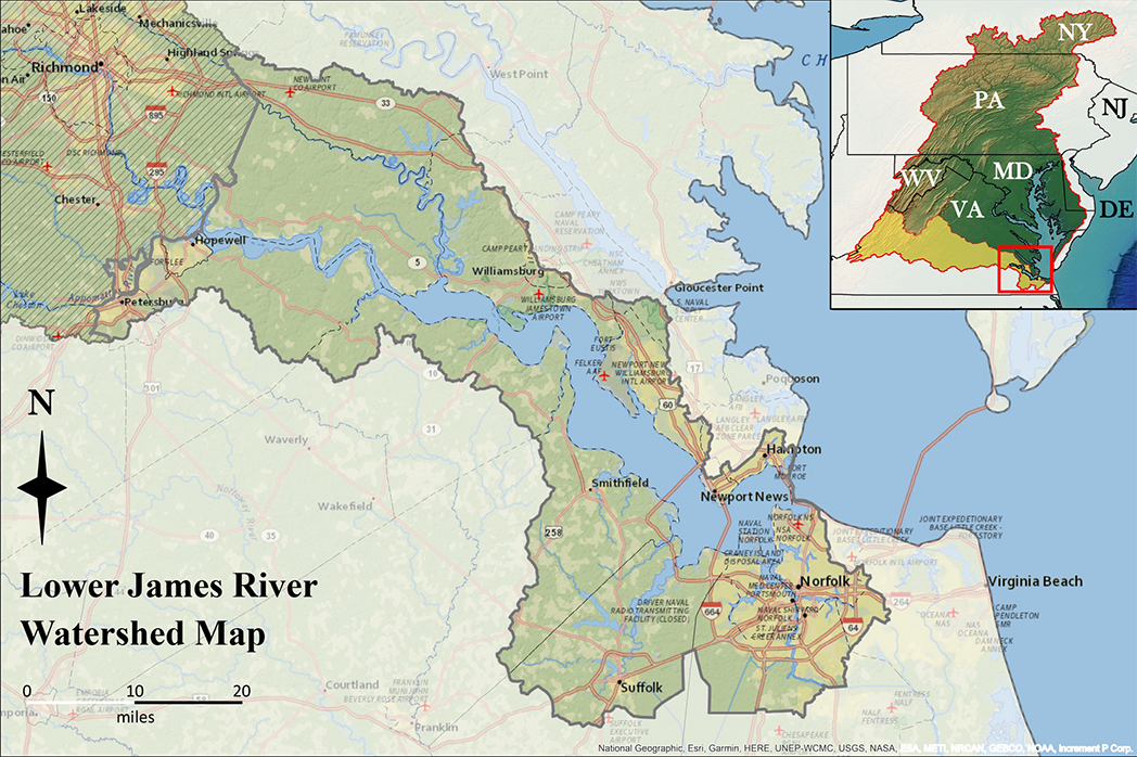
The Lower James River runs from the fall line in Richmond to the Chesapeake Bay. Its watershed lies in the Coastal Plain region of Virginia, which includes the Cities of Colonial Heights, Hampton, Hopewell, Newport News, Norfolk, Petersburg, Portsmouth, Virginia Beach, and Williamsburg; Counties of Charles City, Chesapeake, Isle of Wight, James City, New Kent, Prince George, Suffolk, and Surry.
|
Click to see a map of the Lower James (PDF)
|
|
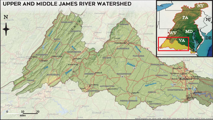
The Middle James River travels from Lynchburg and ends at the fall line in Richmond. Its watershed lies within the Piedmont region of Virginia, which includes the Cities of Charlottesville,Lynchburg, and Richmond; Counties of Albemarle, Amelia, Amherst, Appomattox, Bedford, Buckingham, Campbell, Chesterfield, Cumberland, Dinwiddie, Fluvanna, Goochland, Greene, Hanover, Henrico, Nelson, Powhatan, Prince Edward, Nottoway, and a small area of Louisa.
|
Click to see larger map (PDF)
|
The Upper James River starts at the confluence of the Cowpasture and Jackson Rivers in Botetourt County and travels through the mountains to Lynchburg. Its watershed lies in the Blue Ridge and the Valley and Ridge regions of Virginia, which includes the Cities of Buena Vista, Covington, Lexington, and a small area of Roanoke; Counties of Alleghany, Augusta, Bath, Botetourt, Craig, Highland, Rockbridge; and small areas of Giles and Montgomery. See map above.